Geological database GEO DB

GEO DB is a geological and geotechnical database that compiles data from drilling, field tests and laboratory studies. GEO DB is equipped with a set of analytical tools, advanced statistical methods and documentation tools (borehole logs, reports, charts, sections, maps, etc.).
GEO DB includes a set of tools for entering, analyzing and interpreting dynamic soundings SPT, DPL, DPM, DPH and DPSH.
Geo DB allows you to collect hydrogeological information from piezometric measurements and well performance measurements. Reports from such measurements contain information about the construction of the piezometer/well and the results of measurements over time.
The program is dedicated especially to medium and large enterprises, where work is performed by large teams, but also (in the version with MS SQL Express Server) it can be effectively used by small companies with 1-10 workstations.
Main features of the program:
- Local and network databases
- Working with Access, MS SQL Express Server and MS SQL Server
- Possibility to enter soil classification and create borehole logs in different classification standards
- USCS, PN-B-02480, PN-EN ISO 14688-1 and PN-EN ISO 14689-1 standards included
- Ability to enter data and create documentation in any language
- Built-in CAD vector graphics
- Configurable borehole log
- Reports
- Maps, sections, contours
- Elements of BIM technology - export to IFC format
- Export to AGS format
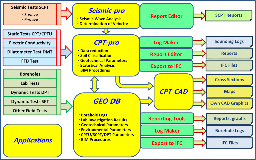
Geo DB provides you with geological, geotechnical, geophysical and geo-environmental data management for subsurface projects. The software enables effective data collection, quick access to data and instant generation of reports and logs. All data is stored in the database. Versions based on MS Access, MS SQL Express Server and MS SQL Server are available.
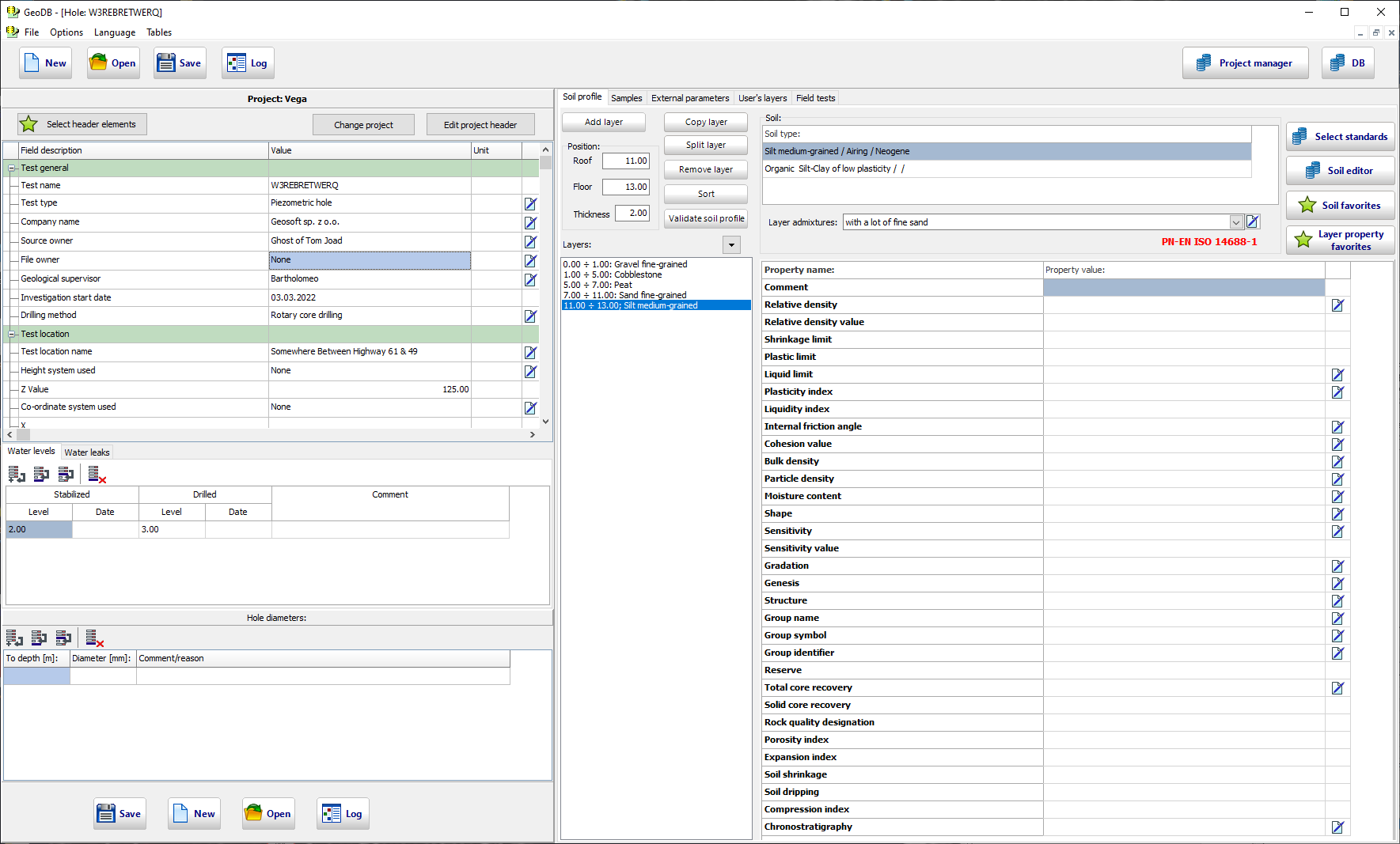
Due to different soil description systems and properties in different countries, Geo DB allows for the input of data in different standards. The USCS, ISO 14688-1, ISO 14689-1 and PN-B-02480 standards as well as tools for introducing new User standards are implemented in the Geo DB database.
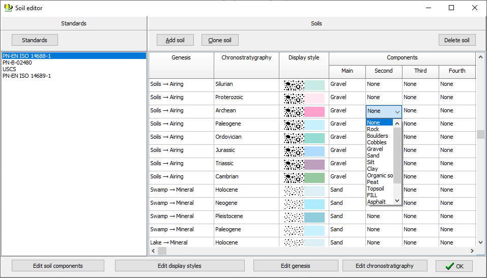
The program includes the entered soil types in accordance with the USCS, ISO 14688-1, ISO 14689-1 i PN-B-02480 standards. Each soil is represented by name, pattern, color, genesis and chronostratigraphy. Built-in Soil Type Editor allows you to create your own soil types according to any national or local standard.
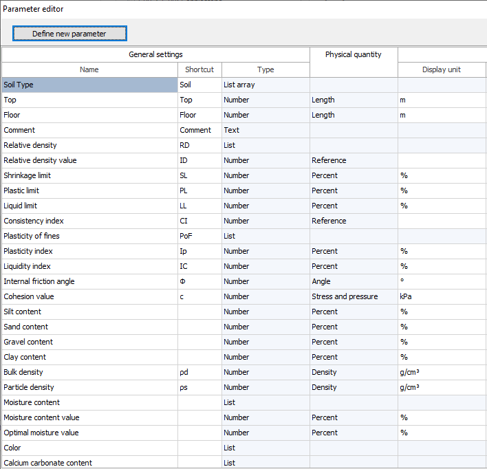
The Geo DB program allows you to enter practically all geotechnical parameters that have a single numerical value at a given point or sample. Those that are in common use are implemented, additionally - the built-in Parameter Editor allows you to create any new ones.
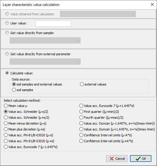
The GEO DB program includes procedures for automatic estimation of the characteristic values of parameters based on the results of laboratory tests according to. method selected by the User. Advanced statistical methods are implemented (Eurocode 7, PN-81/B-03020, Schneider 1997, average value, Duncan 2000, Confidence Interval Limits) and additionally - the possibility of indicating the value defined in standards or value from other studies. All statistical calculations are performed automatically according to method selected by the User.
The characteristic values can be calculated for a single hole or for a selected set of holes in total.
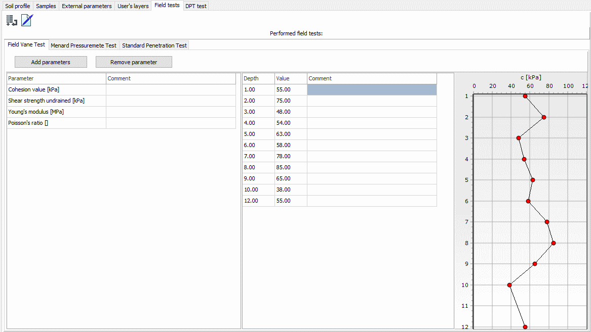
GEO DB allows you to enter native values and values interpreted from field tests (e.g. pore pressure measurement with a stationary sensor, pressiometric Menard modulus, shear strength and soil sensitivity determined in the FVT test, etc.).
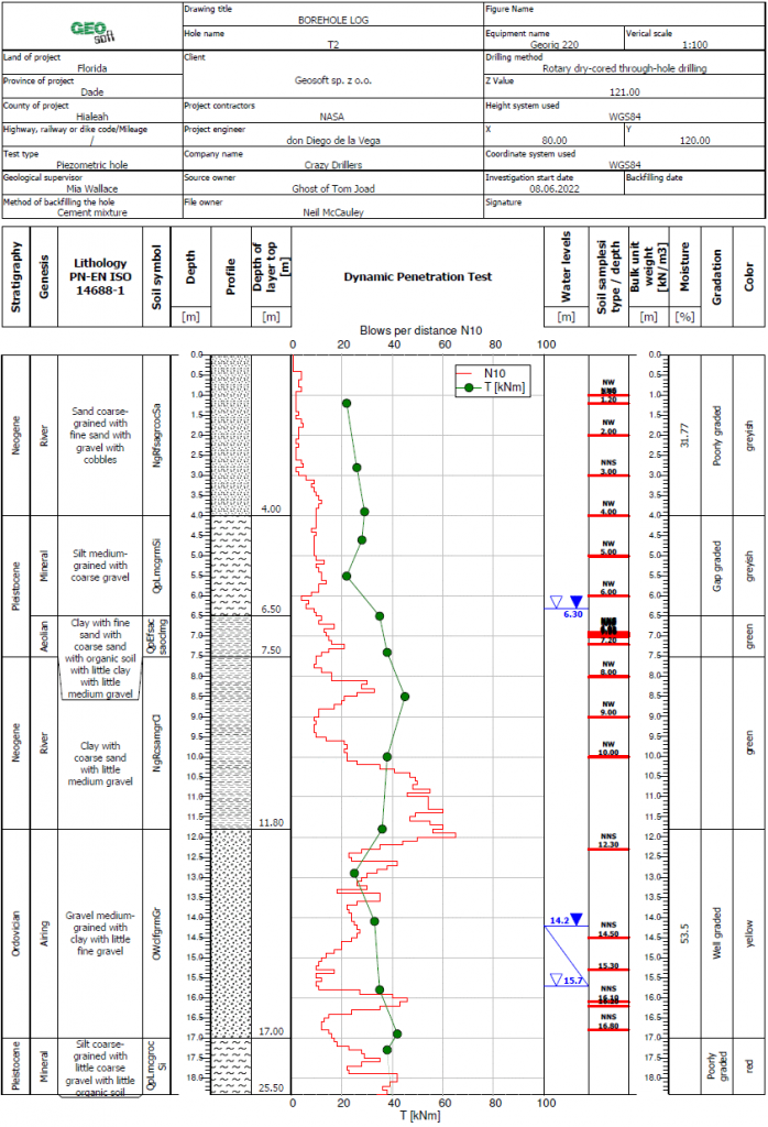
Borehole log
The GEO DB program enables the automatic generation of a borehole log containing any set of information related to the selected hole. The borehole log (see below) is fully editable by the User, including the ability to change the contents of the header fields as well as the width and content of individual columns. The geological profile can be represented by filling with patterns or colors assigned to specific soil types.
The GEO DB program contains a number of different borehole log patterns, differing in the number of cells in the header table and the number and type/content of columns.
Laboratory tests
The GEO DB program allows for the registration of laboratory test results of soils and rocks and for the estimation of characteristic values of geotechnical parameters based on sample tests and statistical methods.
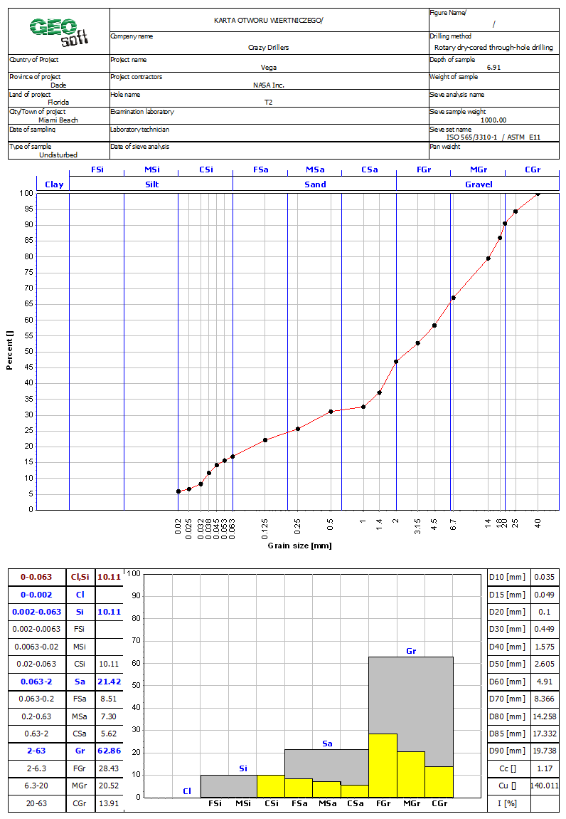
An important element of laboratory tests is sieve analysis. Sieve sizes can be defined by the User depending on the standard used and laboratory equipment.
The selection of a classification standard results in the boundaries between individual soil fractions consistent with this classification standard being plotted on the grain size chart and the appropriate histogram configuration.
The classification standards and sieve set standards are independent of each other. Individual fields in the report header table have the same functionality as fields in the hole card header table.
BIM technology
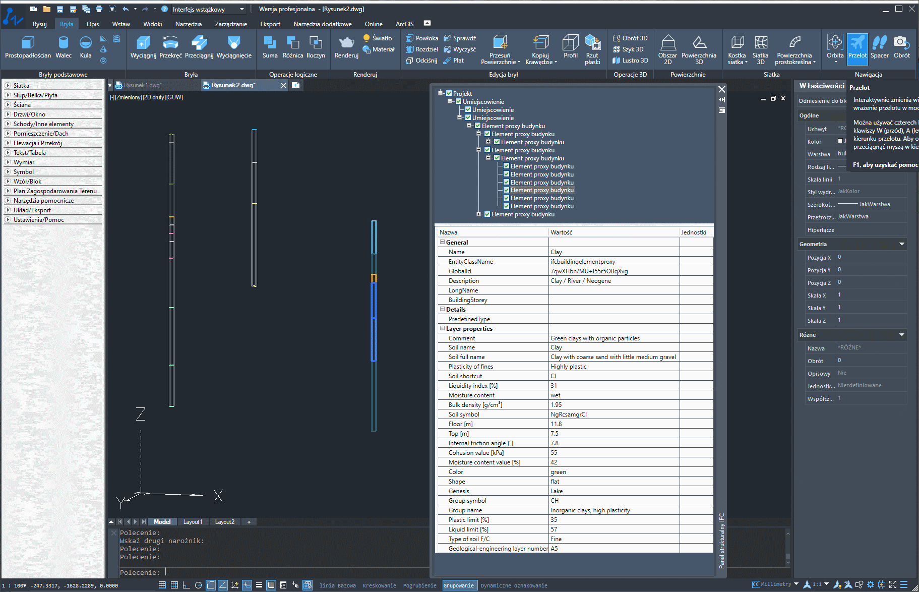
IFC 2x3 file generated in GEO DB and opened in ZW CAD
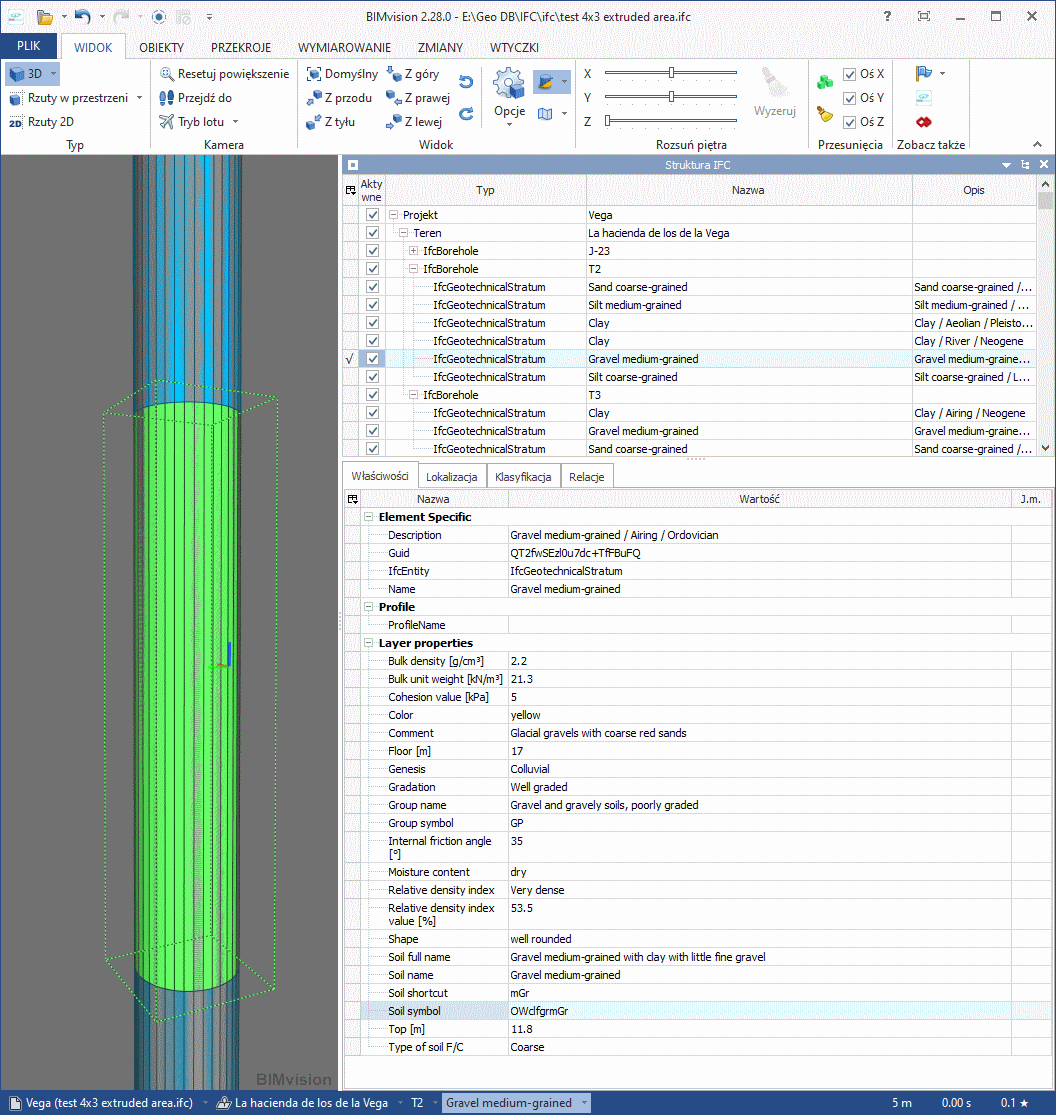
IFC 4x3 file generated in GEO DB and opened in BIMvision